Win a Breathtaking Bryson City Giveaway
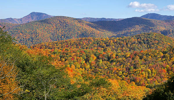
To take a road less traveled, drive to Balsam Mountain via the Heintooga Ridge Road that starts at the Blue Ridge Parkway at Milepost 458.2, just 11 miles from the south end of the Parkway. (Not to be confused with Black Balsam Knob, 38 miles north on the Parkway.) For the first four miles of this paved, two-lane road, you are still in the Blue Ridge Parkway National Park boundaries, complete with some nice high-elevation overlooks looking down on the mountain ridges. Then you enter the Great Smoky Mountains National Park and continue another five miles to the end of the paved section. Here you will find a picnic area and the beautiful Heintooga Overlook. The one-lane unpaved Heintooga Round Bottom Road begins there. Heintooga Ridge and Balsam Mountain Roads are usually open from late May through October.
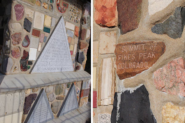
At Black Camp Gap at the entrance to the Great Smoky Mountains National Park, there’s an interesting memorial erected by Masonic orders from around the country. This stone monument was built when the park was created and contains examples of rock types from most states and many places throughout the world.
Along the way, you will pass the Balsam Mountain Campground. This area is one of the better high-elevation birding destinations in this region. During the breeding season, see golden-crowned kinglets, hairy woodpeckers, veerys, winter wrens, brown creepers, black-capped chickadees, red-breasted nuthatches, blue-headed vireos, and Blackburnian, black-throated, and Canada warblers.
Balsam Mountain offers the highest tent camping within the Great Smoky Mountains National Park. When the campground was set up in the 1930s, builders had tent campers in mind. But, even with the small sites close together, you will find ample privacy since the campground rarely fills. It's open mid May to late September.
Flat Creek Trail
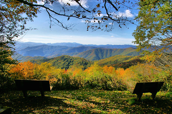
At the end of the paved section at the picnic area, there is the Flat Creek hiking trail. Shortly after beginning the trail, you will come to the Heintooga Overlook with two benches to relax on and enjoy the views of the Great Smoky Mountains. Continue on the trail for two miles through a beautiful high-elevation forest. The Flat Creek Trail is 2.6 miles from end-to-end.
Heintooga-Round Bottom Road
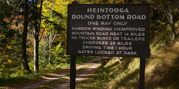
For a more adventurous drive (or what we call "car hiking"), take the rustic forest drive on the Heintooga-Round Bottom Road, beginning at the end of the paved road at the picnic area. The one-lane gravel road and runs north along Balsam Mountain before descending into Straight Fork valley to emerge at the nearby Qualla Cherokee Indian Reservation. There are several hiking trails along the way, including Palmer Creek Trail, which descends into a beautiful richly forested valley; or the Hyatt Ridge Trail, which, along with the Beech Gap Trail, makes for a rewarding high-country loop hike of eight miles.
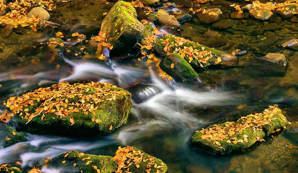
Pass beautiful cascades. Photographers enjoy many scenic areas to capture. Very few cars travel this road each day. Watch for wildlife, including black bears running across the road. The 14-mile Heintooga-Round Bottom Road begins its curving route from an altitude of 5,535 feet and descends to about 2,000 feet. This rough road is not suitable for RVs and trailers and is open late spring through early fall. It will take about an hour to travel this route, which showcases the botanical diversity of the Great Smoky Mountains National Park through stands of beech and birch, followed by hemlocks, maples, and oaks.
At the broad, flat area known as Round Bottom, the one-lane road becomes two-way before it joins the paved, two-way Big Cove Road north of Cherokee. Go downhill about ten miles to Cherokee. Stop at Mingo Falls along the way.


