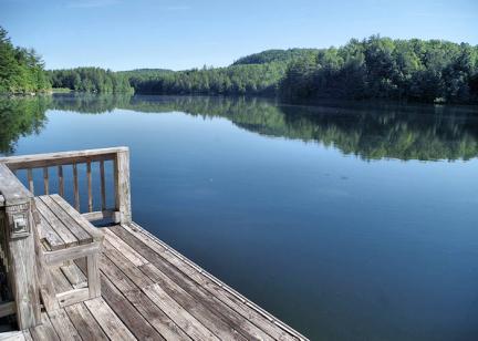
Win a Breathtaking Bryson City Giveaway

The 4.5-mile loop hike on Cedar Rock Mountain in DuPont State Recreational Forest provides wonderful mountain views and dramatic scenery. Rising only a few hundred feet above the surrounding plateau, Cedar Rock Mountain contains some of the most exposed granite in western North Carolina. Hundreds of acres alternate between bare and moss/lichen covered rock. The area is a local favorite with both hikers and mountain bikers. It's a short drive from the very busy High Falls parking area (visitor center & restrooms), but most miss this jewel of of hike that offers plenty of variety. Park at the Corn Mill Shoals Access area on Casade Lake Road (directions at bottom of page). Cedar Rock is about 43 miles from Asheville, located between Brevard and Hendersonville.
There are many connecting trails in this area, so you can easily extend your hike or ride. Trails vary from mostly flat to short but steep sections on the rock face. Just a few miles away are Hooker Falls, Triple Falls, Bridal Veil Falls and High Falls. So you have many options for a second hike on the same day. For more nearby hikes, see our DuPont Waterfalls Guide. Roadside Merry Falls is also nearby along an unpaved scenic drive.
Hike Details
The Cedar Rock loop hike includes parts of three trails. So be sure to take directions with you, since signage is limited. From the parking area (Corn Mills Shoals), cross the road and proceed around the gate on the Corn's Mill Shoals Trail. Continue past Longside Trail (on the left). About 1/10 mile past the gate as the road curves right, turn left on Big Rock Trail, an old roadbed leading uphill. Continue up the steady grade about 1/2 mile until the trail leads across a series of granite slab with great mountain views. Be sure to take a map with you! Stay on the trail and avoid stepping on flat, loose rocks. Protected species like small-footed bats and rattlesnakes often nest under them.
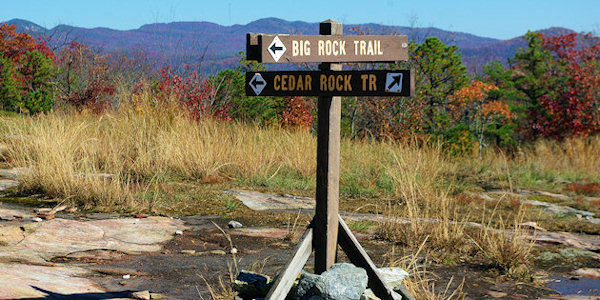
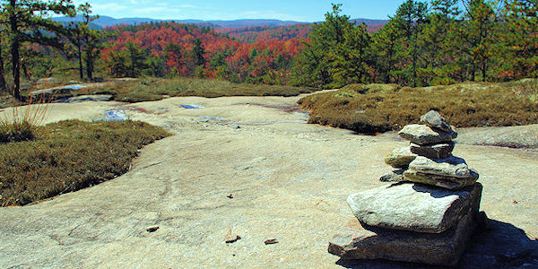
After re-entering the forest, approach a much larger granite dome with excellent views west of Pisgah National Forest. At the top of this granite clearing, continue into the forest and around several turns until the path leads back onto a large, nearly flat granite area (used as a heliport by the Forest Service). This is a three-way intersection where Big Rock Trail terminates into Cedar Rock Trail (pic above).
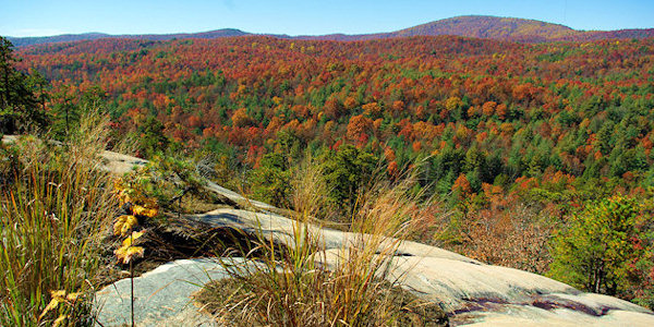
Turn right on Cedar Rock Trail and hike southeast down the mountain. Continue along the trail, stepping around the moss to protect it. The trail turns right into the forest, and then back out onto a sloping granite field with views toward Pinnacle Mountain and Stone Mountain. Follow the trail through some trees and then back down a steeper granite incline.
Re-enter the forest and reach the Little River Trail. Turn right and cross Tom's Creek. Continue parallel to the Little River for about a mile (mostly level), then intersect with the Corn Mill Shoals Trail. Continue straight ahead (toward right) on Corn Mills Shoals Trail for about 3/4 of a mile to return to the beginning of your hike and the parking area.
Download a PDF of the DuPont Forest Trails Map. Save it to your phone before your go. 4 MB.
Driving Directions to Cone Mills Shoals Access Area in DuPont State Forest (See area on Google Maps)
From Asheville via Brevard: Take I-26 east to Exit 40, and take NC-280 toward Pisgah Forest. Turn left (east) on US-64 and go 3.7 miles to the gas station in Penrose. Turn right on Crab Creek Rd. and continue 4.3 miles and turn right on DuPont Rd. for 5.3 miles (road turns into Staton Road). Go past the Hooker Falls and High Falls Access Areas and turn left at the end of Staton Road on Cascade Lake Road. The Corn Mills Shoals Access Area is 0.8 miles on the right.
From Hendersonville: Take Business US-25 (Church St.) south to Kanuga and turn right. Kanuga becomes Crab Creek Rd. after 3.9 miles at Little River Rd. (flashing traffic light). Continue on Crab Creek 7.1 miles to DuPont Rd. Turn left for 5.3 miles (road turns into Staton Road). Go past the Hooker Falls and High Falls Access Areas to a left at the end of Staton Road on Cascade Lake Road. The Corn Mills Shoals Access Area is 0.8 miles on the right.
From downtown Brevard, it's a quick drive out US 276 south (about 11 miles) to Cascade Lake Road. Turn right and go 1.8 miles to parking area on left.
Leave No Trace
This is a beautiful hike in a beautiful forest. Will you help keep it that way? Mare sure you know the seven principles of Leave No Trace.