Win a Downtown Asheville Stay + VIP Event Tickets
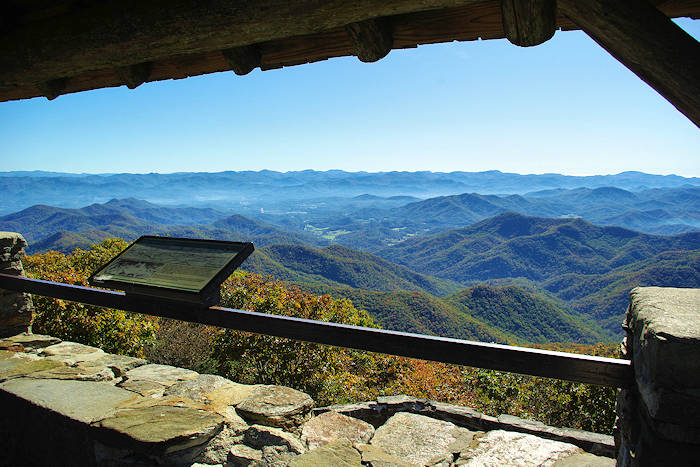
Wayah Bald has a vantage point of 5,342 ft. in elevation in the Nantahala National Forest, near Franklin, North Carolina. On a clear day, you can see north to the Great Smoky Mountains in Tennessee and south into the rolling hills of Georgia. Take a short hike from the summit parking area to climb an old stone fire tower, built in 1937 by the Civilian Conservation Corps, to witness panoramic views of the southern Appalachian mountain chain. Forest Service Road 69, which runs from Wayah Road to the Bald, is closed January-March. While it's 87 miles from Asheville, there's much to do in the area for a day trip.
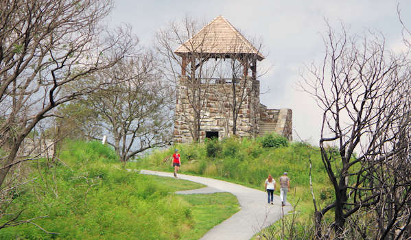
We are delighted that the roof was rebuilt in early 2018 after a wildfire burned it in late 2016. You'll see the burned trees at the summit, but the entire drive up the mountain is very green!
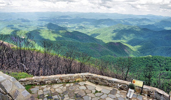
Situated along both the Appalachian Trail and Bartram Trail, the 53-ft., three-story stone lookout on Wayah Bald was decommissioned in the 1940s. It was listed on the National Historic Lookout Register in 2007, and there is no admission charge. Signs on top of the tower educate visitors on the surrounding mountains. There are toilets at the parking area, a welcome sight in the forest! Find a small picnic area at the very end of the turnaround.
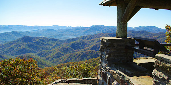
When built in 1937, Wayah Bald Fire Tower had an interior stairway to the second story, where an external wooden catwalk encircled a public observation level enclosed by 12 windows. The third story housed fire-detecting equipment and served as the lookout, with 16 windows providing a 360-degree view of the Nantahala National Forest. It also contained living quarters for the watchmen, including two drop-down beds attached to the wall and a wood stove for cooking and heat. These amenities allowed uninterrupted lookout service for up to two months at a time. Food, water and mail were delivered weekly by the nearby CCC camp. By the mid-1940s, cracks began to develop in the stone tower, allowing water in and damage to begin. Since there were other nearby lookouts, the fire detection service at Wayah Bald was stopped in 1945. Two years later, the forest service removed the upper levels of the tower for safety reasons.
The bald is especially beautiful in May and June when the rhododendron, azaleas, and other wildflowers bloom. Evidence of Indian use of the bald as hunting grounds dates back to 300 BC. Wayah is a Cherokee word for "wolf," and the bald was named for the red wolves that roamed in abundance here.
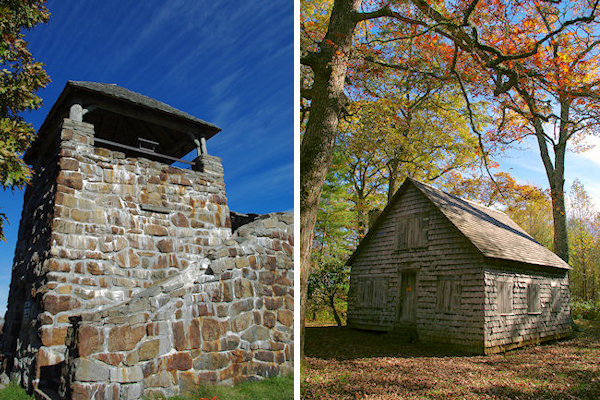
Wayah's bald area is small, surrounded small trees stunted and pruned by the strong winds and icy winter weather. On the drive to Wayah Bald, you can stop at the Wilson Lick Ranger Station (about three miles before you reach the summit). Built in 1916, Wilson Lick gives you a glimpse of a bygone era of forestry. Read about the history of forestry and see the historic structures. You can hike from here to the Wayah Bald - a 3-mile hike on the Appalachian Trail.
Bartram Trail is a 115-mile National Recreation Trail that stretches from northern Georgia to Cheoah Bald in North Carolina, named for William Bartram, a major American naturalist.
Wesser Bald Lookout Tower is located north on the Appalachian Trail, and it can be accessed by a four-mile round-trip hike. Find more historic fire lookout towers to climb in the NC mountains.
Directions
To reach Wayah Bald Lookout Tower Trail from Franklin, North Carolina, travel west along US 64 (Mountain Waters Byway) for 3.7 miles and turn right at the Wayah Bald directional sign (right on Old Murphy Road/State Road 1442, then a quick left onto State Road 1310/Wayah Road). Go 9 miles, turn right onto unpaved National Forest Road 69, at the top of the ridge at the Appalachian Trail crossing, and go 4.3 miles to the end. Forest Service Road 69 is usually a packed gravel surface. 4-wheel drive is not needed. Closed January-March. It's 87 miles from Asheville.
See more things to do in the Franklin area.

