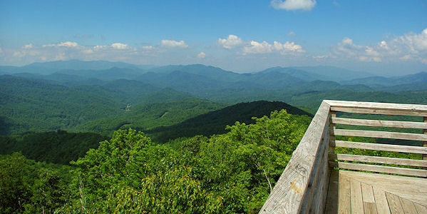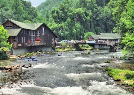
The 30-foot tall tower atop Wesser Bald, North Carolina, on the Appalachian Trail provides 360-degree mountain views of the Nantahala National Forest and the Great Smoky Mountains. The original tower was built 1936 by the Civilian Conversation Corps as a live-in lookout. The live-in cab was destroyed by arson in 1979 and replaced in the early 1990s by the USFS with the current observation deck for hikers. The four mile roundtrip to the summit is a gradual and steady climb. Park at Tellico Gap and head north. The trail goes through dense forests with no mountain views until you reach the top (trees have overtaken the once bald summit). At the summit, you'll see a short 100-ft trail on the right that leads you to the tower. Wesser Bald is located north of Franklin and south of the popular rafting area along the Nantahala River.

To the North, you see the Smoky Mountains across a portion of Fontana Lake and the Balsam Mountains. East is the Tellico Valley, and the Little Tennessee River valley. South there is the Nantahala Ridge, hiding nearby Wayah Bald, but Winespring Bald shows it's towers. To the West are the Valley River Mountains, the Snowbirds, and the Slickrock Range.
Find more historic fire lookout towers to climb in the North Carolina mountains.

Directions from Franklin: To reach the trailhead in Tellico Gap, follow route 28 North 12 miles out of Franklin. Turn left across the white concrete onto Tellico Road and bear right to follow this road as it climbs 8.3 miles through scenic Tellico valley, passes Tellico Trout farm, and finally climbs steeply up to the gap atop the ridge. It's paved the first 3.8 miles. You'll see the AT sign and parking spaces. Follow the Appalachian Trail North - (away from the power-line and starting next to the fire-road).
Directions from Nantahala River Rafting Area/Bryson City: Take Wayah Road south from US 19/74 (popular spot to put rafts in for the trip down river) for five miles. Turn left on Otter Creek Road and drive 4.1 miles to Tellico Gap. The road is paved for the first 2.8 miles.


