Win a Downtown Asheville Stay + VIP Event Tickets
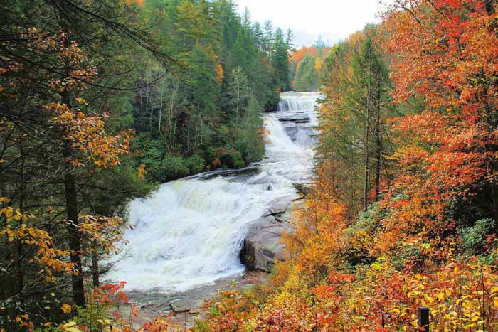
The moderate hike includes three waterfalls and is the most popular waterfall hike near Asheville. It includes Hooker Falls Trail, Triple Falls Trail, and High Falls Loop.
Since DuPont State Recreational Forest was saved from real estate development, its 12,000 acres and 86 miles of trails have become a favorite playland for exploring the great outdoors. This three-mile hike to three waterfalls is the most popular waterfall hike near Asheville and our favorite. Since it's so popular, weekends bring big crowds, especially in the summer and fall. Remember, you can always visit during the week or early in the morning to miss the masses. See our DuPont State Recreational Forest Guide for more info and other places to explore there.
Park at the Hooker Falls access area at DuPont State Recreational Forest (see driving directions below) for this three-mile hike to three waterfalls along the Little River. You can also park at the High Falls access about a mile down the road (with Visitor Center). Then you reverse the hike, seeing Hooker Falls last.
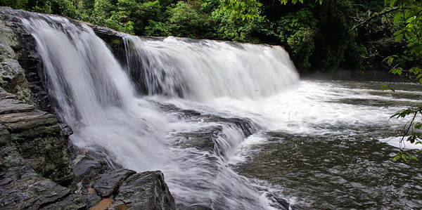
Hooker Falls
From the Hooker Falls parking area (adjacent to the river), take a short walk to Hooker Falls. The base of the waterfalls s is a popular spot for wading and swimming. The Hooker Falls parking is shaped like a figure eight. The trail is located where the two circles of the figure eight join. From Hooker Falls, retrace your steps back to the Hooker Falls parking lot. Then, look for the pedestrian bridge to access the trail to the impressive Triple Falls and High Falls. See more photos of Hooker Falls.
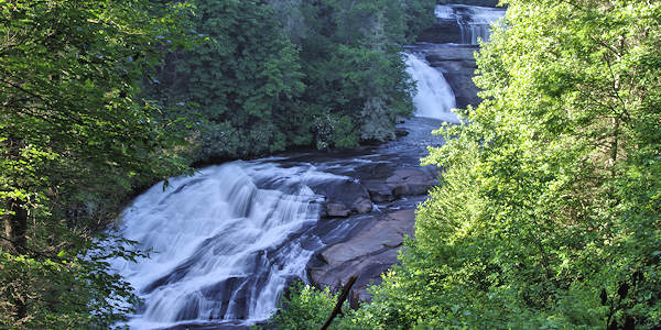
Triple Falls
Less than 1/2-mile from the Hooker Falls parking lot and up the Triple Falls trail. Arrive at an overlook for Triple Falls with three cascades over a total 120-ft. drop. Just past the overlook, a trail forks off to the left and heads down via a big staircase to land on a large rock area below the top two falls and atop the third (photo at top of page). For your safety, remember to stay behind the cable barrier. See more photos of Triple Falls.
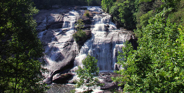
High Falls
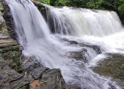
From Triple Falls, continue about 1/2-mile on the High Falls Trail to the largest waterfall, a 150-ft. cascade down an inclined plane of granite. If you want a close-up look, look for the "Base of Falls" spur trail that takes you down to the river. If the river is not running high, you can rock hop along the river edge to reach the big boulders in front of the waterfall. Don't attempt to climb the rocks by the waterfall since they are very slick and dangerous. That will add another half mile for this detour. Return to the main trail and turn left and head up hill for a view in the photo above. Winter views are even better with leafless trees and you often have the forest to yourself in early mornings. See more info about High Falls.
From here, return to your car via the same trail. Or you can extend your hike to the Covered Bridge above High Falls and beyond. See our DuPont State Recreational Forest Guide for more hikes, including a four-mile hike to the hidden lakes.
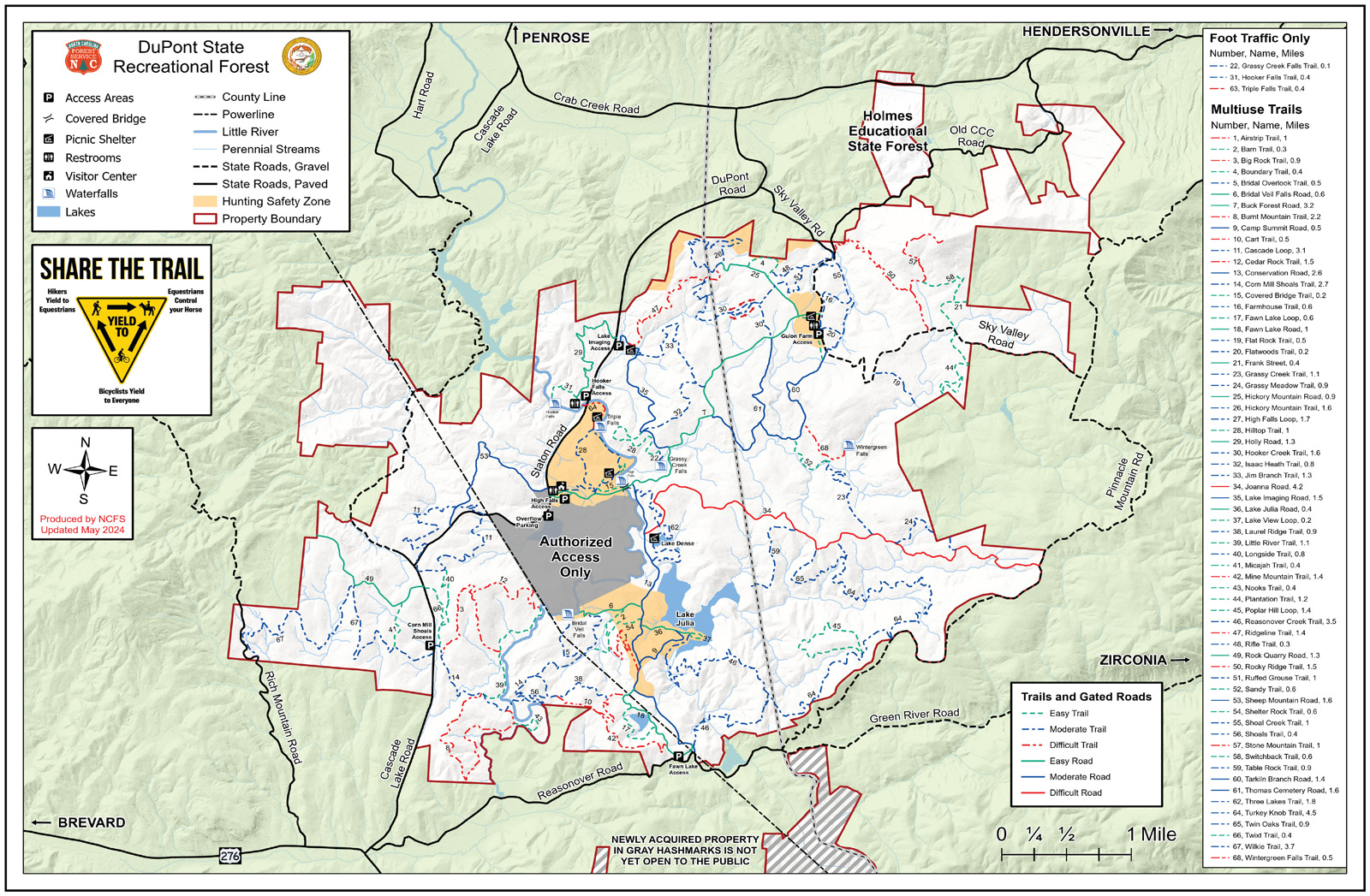
Download a PDF of the DuPont Forest Trails Map. Save it to your phone before your go. 4 MB. Above is the section of the map for this hike.
DuPont State Recreational Forest Directions
Directions from Asheville (via Brevard) to Hooker Falls Access Area: I-26 East to exit 40 for Highway 280/Airport exit toward Brevard. Turn right onto 280 and drive about 16 miles. Turn left on US-64 as you enter Brevard past Wal-Mart. Travel east on US-64 for 3.7 miles to the gas station in Penrose. Turn right on Crab Creek Rd and continue 4.3 miles and turn right on DuPont Road. Ascend and descend; after 3.1 miles, find the Hooker Falls parking area on the right just before the Little River bridge. (High Falls parking area with the DuPont Visitor Center is a mile farther down the road. You can hike to these falls from there also.)
Nearby
Brevard Adventure Guide
Order your free 48-page Adventure Guide for Brevard and Transylvania County, Land of the Waterfalls, with scenic drives, hikes, waterfall map, festivals, art, museums and picturesque Main Street… read more
Order your free 48-page Adventure Guide for Brevard and Transylvania County, Land of the Waterfalls, with scenic drives, hikes, waterfall map, festivals, art, museums and picturesque Main Street.
Restaurants in Brevard
Find a variety of places to eat and drink in Brevard including upscale dining casual eateries, pubs, food trucks, bakeries, coffee shops, and more!
Find a variety of places to eat and drink in Brevard including upscale dining casual eateries, pubs, food trucks, bakeries, coffee shops, and more!
Brevard Places to Stay
Find cabins of all sizes, hotels, B&Bs and luxury inns in the Brevard area from their official visitor center. It's the Land of Waterfalls. Includes Pisgah National Forest and DuPont… read more
Find cabins of all sizes, hotels, B&Bs and luxury inns in the Brevard area from their official visitor center. It's the Land of Waterfalls. Includes Pisgah National Forest and DuPont State Forest.
