Biltmore's Annual Pass Sale Is Live - Limited Time Offer
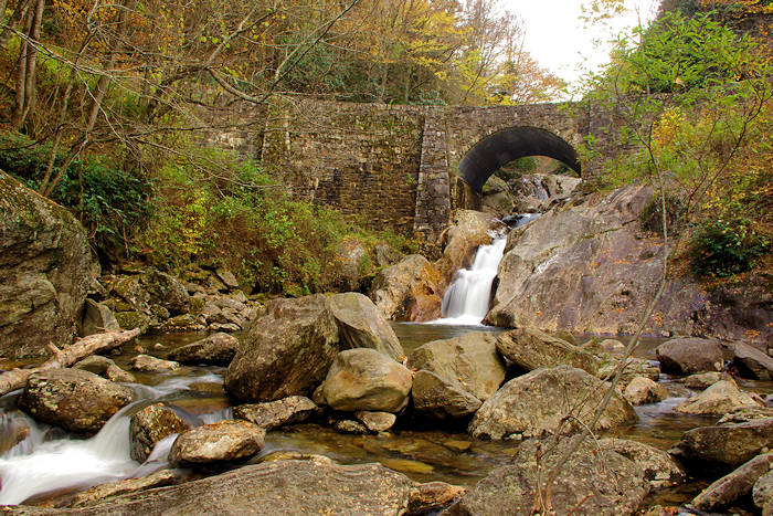
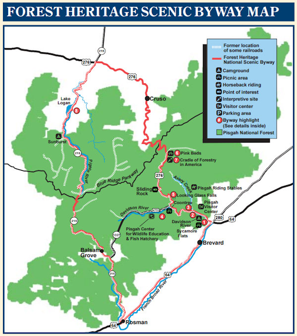
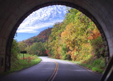
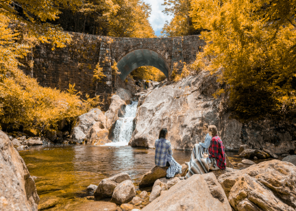
This 76-mile mountain scenic drive is packed with things to see and do, including plenty of waterfalls, picnic spots and hiking trails. The Forest Heritage National Scenic Byway is highlighted by beautiful mountain scenery and rich local history in the Blue Ridge Mountains of North Carolina. It's a great way to explore Pisgah National Forest, and iconic places along with way like Sliding Rock, Looking Glass Falls and Looking Glass Rock. You could take an entire day to drive the winding route and stop at the many places along the way. Elevation ranges from around 2,100 feet in Brevard to 5,340 feet! It's not recommended for RVs. Pic at the top is Sunburst Falls.
Favorite 15-Mile Section
The Byway follows several highways to form a loop (so it's usually not listed on GPS or most maps). Our favorite section starts in Brevard and winds 15 miles by a river, waterfalls and great hikes to the Blue Ridge Parkway. From Asheville, take NC 280 (from the Airport area) south to Brevard and turn right onto US 276 as soon as you enter town. You will immediately leave the shopping centers and enter into the tranquility of the forest. Here's a mile-by-mile guide of what you'll see:
- Mile 0.1: Pisgah Forest stone pillars built to honor Transylvania County residents who served in World War I to mark the entrance.
- Mile 0.4: Sycamore Flats Picnic Area along the Davidson River, a popular tubing spot in the summer.
- Mile 1.2: Davidson Campground open year-round with 160 campsites (see our camping guide).
- Mile 1.5: Ranger Station and Visitor Center/restrooms.
- Mile 2.1: Forest Service Road 477 on right - to Pisgah Riding Stables (guided horseback rides) and Twin Falls hike.
- Mile 4.8: Coontree Picnic Area & Restrooms.
- Mile 5.2: Forest Service Road 475 on left - goes to Looking Glass Rock Hike, John Rock Hike, Pisgah Center for Wildlife Education & Fish Hatchery, Daniel Ridge Falls and Cove Creek Falls.
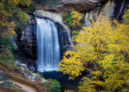
- Mile 5.6: Looking Glass Falls roadside 85-ft. waterfall with steps to the base.
- Mile 6.6: Moore Cove Falls hike (parking on right).
- Mile 7.7: Sliding Rock, a very popular summer swimming hole.
- Mile 10.2: Forest Service Road 475B to the left - goes to Log Hollow Falls.
- Mile 10.9: Forest Service Road 477 returns to the highway on right (scenic unpaved drive).
- Mile 11.0: Cradle of Forestry (open mid-April to early November), the birthplace of American forestry with exhibits, historic buildings and paved trails.
- Mile 11. 3: Pink Beds, an upland bog with a dense growth of pink blooming rhododendrons and laurels. Stop for a five-mile hike or a picnic.
- Mile 15: Blue Ridge Parkway (go north on the Parkway for Mt. Pisgah and very scenic drive back to Asheville).
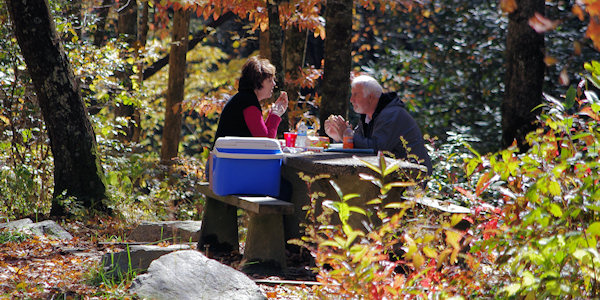
You can drive a section or allow at least two hours to drive the entire route. There are plenty of great stops for picnics along the way. The byway is also known as "Copperhead Loop," a popular motorcycle drive with many twists and curves.
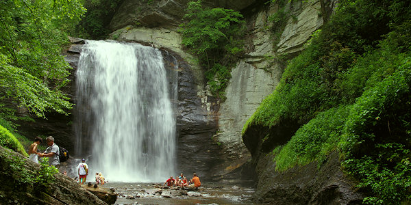
Looking Glass Falls
The Rest of the Drive
The first crossing of Forest Heritage Scenic Byway (US 276) with the Blue Ridge Parkway is Wagon Road Gap. The gap was named for the vehicles that crossed the mountain on the trail from Brevard towards the Pigeon River Gorge and Tennessee. To the left is the Shining Rock Wilderness. Accessible only by foot trails, this primitive area is a unique natural resource. Follow the upper reaches of the East Fork of the Pigeon River through rural mountain villages (including Cruso and Bethel) and farm lands for 14 miles to the intersection of NC 215.
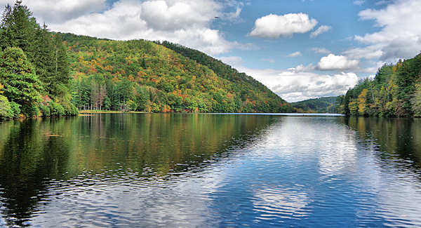
Lake Logan
NC 215
In the nearby community of Woodrow, just north of Bethel, turn left at the stoplight onto NC 215. Follow the West Fork of the Pigeon River for 18 miles until you reach the second crossing of the Blue Ridge Parkway at Beech Gap. Along this portion of NC 215, pass by more mountain farms and numerous streams and falls. Six miles from Woodrow, pass beautiful Lake Logan - an Episcopal retreat center. The community of Sunburst, located along the shores of the lake, gets its name from the swiftness of the sun as it rises over Cold Mountain to announce the morning.
Pass over Sunburst Falls, and stop there to enjoy the nice cascades and the historic stone arched bridge (pic at top of page). About three miles ahead is the hike to Wildcat Falls.
After you cross the Blue Ridge Parkway for the second time, enjoy lofty mountain views from NC 215 at Beech Gap (elevation 5,340 feet). At just over two miles, find the easy hike to Dill Falls. At 6.7 miles south of the Parkway, take a detour to see Courthouse Falls. About 8.5 miles from the Blue Ridge Parkway you’ll arrive in the Balsam Grove community near Balsam Lake which feeds into the French Broad River. Stop to see the twin waterfalls, Cathedral Falls & French Broad Falls. The river was named for the French who inhabited the territory during the 18th century. For the last eight miles, the road parallels the North Fork of the French Broad River. At the intersection of NC 215 with US 64 near Rosman, the byway follows US 64 East back to Brevard.
Continue your scenic journey by following the Waterfall Byway west along US Highway 64 toward Cashiers or turn left on US 64 to Brevard.
There are 149 federally nationally-recognized scenic byways in the country. Forest Heritage National Scenic Byway is one of four such byways in North Carolina.
TIPS FOR MOUNTAIN DRIVING
1. Go slowly and enjoy the scenery on the curvy mountain roads. Allow plenty of travel time.
2. Stop only at overlooks to soak in the views. Don't make sudden stops to get that perfect picture. The sharp curves create limited visibility.
3. Take a jacket. With the elevation changes of 3,000+ feet as you drive, the temperature may vary as much as 20 to 30 degrees. At the highest elevations, the hottest summer days only reach into the 70s.
4. Watch for hikers and bicyclists.
5. Gas up before you begin your journey. Gas stations are far between.
6. Restrooms and restaurants can also be a rare site. Plan ahead! Take a picnic.
7. Please do not disturb wildlife or plant life. Bear sightings are rare.
8. Don't rely on GPS only. Cell phone service will be very limited. Have a road map handy.
