Win a Downtown Asheville Stay + VIP Event Tickets

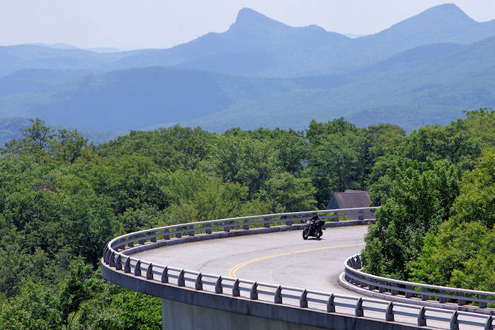
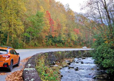
The twists and turns of the mountain roads around Asheville in the Blue Ridge Mountains of North Carolina make for some fun motorcycle drives and rides.
Blue Ridge Parkway
Breathtaking views. Plenty of easy curves. No stoplights, no billboards and no commercial vehicles. The Blue Ridge Parkway is one of the best motorcycle drives in America. The 469-mile long National Park snakes along the ridge of the Blue Ridge Mountains.
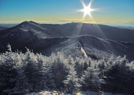
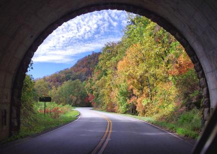
There are several spots around Asheville to access the Parkway. Asheville sits in a valley, so no matter which way you go on the Parkway from town, you will climb quickly in elevation. Ride north to Craggy Gardens and Mt. Mitchell. Or, drive south through a dozen tunnels toward Mt. Pisgah and on to the Great Smoky Mountains. Due to the big changes in altitude while driving (sometimes ascending 3,000 ft. in less than an hour), be prepared for rapidly changing weather.
It's not the drive for speed, with a 45-mph speed limit. Plus, you will encounter many slower drivers that are not in a big hurry to drive past the views. So don't be in a hurry! There are plenty of overlooks to stop. You'll need to exit the Parkway to find food, gas and lodging. We have lots of detailed information in our Blue Ridge Parkway Guide.
The Dragon
About 90 miles from Asheville is The Dragon, a must for great motorcycle rides. Perhaps the most famous drive in the East, navigate 318 curves in 11 miles. It's also called the Tail of the Dragon. This stretch of US 129 near Fontana Dam borders the Great Smoky Mountains National Park and crosses the Tennessee state line. On summer weekends, the Dragon may get 15,000 motorcycles and sports cars a day. See our Dragon Guide.
Black Mountain Rag to Chimney Rock
Take exit 64 off Interstate 40 at Black Mountain to follow the Black Mountain Rag, a scenic route named for an old fiddle tune about the dark green Lauada Firs that give the Black Mountains their name. In musical terms, a "rag" is a tune with multiple twists and curves up and down the scales. This scenic route twists and turns through the mountains like the music itself. Coming from Asheville, turn right off the exit ramp at Black Mountain and follow NC 9 south towards Bat Cave. The road winds along the Rocky Broad River, joining Hickory Nut Creek near the intersection of US 64, US 74 and NC 9 at Bat Cave. Turn left and follow NC 9/ US 64 east to the village of Chimney Rock. At Chimney Rock Park you can drive to the top of the Chimney overlooking Hickory Nut Gorge. Continue past Chimney Rock to see beautiful Lake Lure. Turn around at Lake Lure and head back. Instead of returning via NC 9 in Bat Cave, follow signs for US 74 back to Asheville. Allow 2-3 hours.
The Diamondback
Where can you find more than 190 steep, climbing curves in just 12 miles for your next motorcycle ride? The Diamondback - North Carolina's last alternate route! Sweeping curves, amazing scenery and cool mountain breezes make the Diamondback, NC 226A, one of WNC's last great mountain roadways. The Diamondback is loaded with switchbacks looping almost 360-degrees. Runs of S-curves climb and twist sharply as they snake through lush green Pisgah National Forest en route to the Blue Ridge Parkway, just above Spruce Pine, North Carolina. This heavily wooded trek, from Marion in McDowell County to Switzerland Inn, on the edge of Mitchell County, NC, is an exciting and challenging drive. Two-lanes of smooth, well-marked pavement are flanked by rocky outcroppings, sheer drop-offs and quick, tight hairpin curves. For more, go to diamondbacknc.com.
Copperhead Loop
This ride follows the Forest Heritage Scenic Byway through Pisgah National Forest, starting in Brevard. The complete loop is 77 miles and goes along Davidson River by Looking Glass Falls, Sliding Rock and other scenic spots with a big elevation gain. Much of the drive is through woodlands and crosses the Blue Ridge Parkway twice. See our Forest Heritage Scenic Byway Guide.
Cherohala Skyway
The Cherohala Skyway was completed in the fall of 1996 after being under construction for some 34 years. It is North Carolina's most expensive highway, carrying a price tag of $100 million. Winding up and over 5,400-ft. mountains for 15 miles in North Carolina and descending another 21 miles into the deeply forested backcountry of Tennessee. The road crosses through the Cherokee and Nantahala National Forests, thus the name "Chero...hala." The Skyway is becoming well-known in motorcycling and sportscar circles for it's long, sweeping corners and scenic views.
This road enthusiast's dream connects Robbinsville, North Carolina, with Tellico Plains, Tennessee. It can be desolate at night and extremely dangerous in the winter months. There are no facilities other than restrooms for the entire 36 miles, so make sure you have enough gas to make the crossing. There is little evidence of civilization from views that rival or surpass any from the Blue Ridge Parkway.
The elevations range from 900 ft. above sea level at the Tellico River in Tennessee to over 5,400 ft. above sea level at the Tennessee-North Carolina state line at Haw Knob. It's near the Tail of the Dragon.


