Win a Downtown Asheville Stay + VIP Event Tickets

The challenging Art Loeb Trail is a 30-mile hiking trail located in Pisgah National Forest. The northern end is at the Daniel Boone Boy Scout Camp near Cold Mountain, while the trail's southern end is near the Davidson River Campground, near Brevard in Transylvania County. The Art Loeb Trail crosses four 6,000-foot mountains, including Black Balsam Knob (6,214 ft) near the Blue Ridge Parkway and Tennent Mountain (6,040 ft). Hikers on in the northern part of the trail in the Shining Rock Wilderness will find unmarked trails, so bring a map!
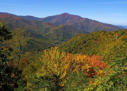
Named one of the 30 Best North American Hikes by National Geographic Adventure, experience spectacular views on the Appalachian balds, the challenging terrain, and the diverse landscape. Most hikers use shorter sections of the trail for day hikes. And there are many connecting trails to form loops (including the Sam Knob area). About 1-2 miles of the trail, from Black Balsam Road to Silvermine Bald, follows the Mountains-to-Sea Trail, which is blazed with white dots. The Black Balsam Knob area is the most popular section due to the sweeping views and easy access to the Blue Ridge Parkway near Graveyard Fields.
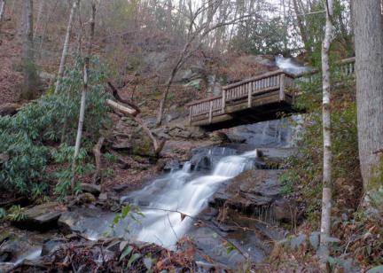
It's a popular trip for an extended backpacking trip (2-5 days) since there are plenty of campsites along the way. If camping in the Shining Rock Wilderness area or anywhere on the trail north of the Blue Ridge Parkway—Sam's Knob, Black Balsam, Graveyard Fields, and beyond—bear canisters are required, and no campfires are permitted. Since the high ridges are exposed, expect much cooler temperatures and wind.
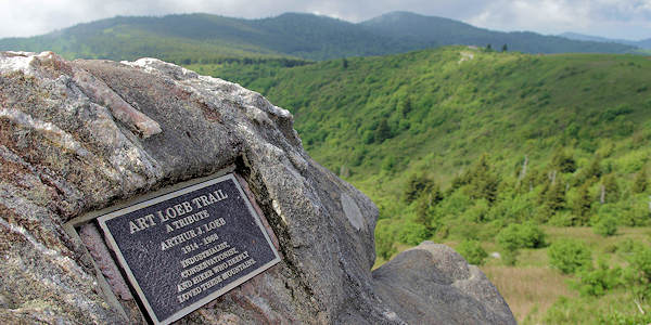
This trail is a memorial to Arthur Loeb, an activist from the Carolina Mountain Club. At Black Balsam, the trail's high point, is a plaque commemorating Art Loeb.
The Art Loeb Trail is split into four sections:
Section 1: South of Pisgah Ranger Station to Gloucester Gap: 12.3 miles
Access: Turn onto the road to the Davidson River Campground near Brevard, NC, 0.2 mile south of the Pisgah District Ranger Station on U.S. Highway 276 and park in the Art Loeb Trailhead parking lot. The trail climbs in a west-southwest direction and curves around Cedar Rock Mountain and then to Gloucester Gap (on Forest Service Road 475).
Section 2: Gloucester Gap to Black Balsam Knob: 7.2 miles
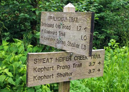
Access: Start from Gloucester Gap, 4.5 miles west of the State Fish Hatchery (near Looking Glass Rock) on Forest Service Road 475. Do not leave cars overnight here. From Gloucester Gap, the trail goes west-northwest before climbing Pilot Mountain, the former site of a fire tower with 360-degree views. Beyond Pilot Mountain is Deep Gap with a shelter and spring. The trail then cuts through Farlow Gap, crosses the Blue Ridge Parkway at Shuck Ridge, and then climbs up to Silvermine Bald at 6,000+ feet and then to Forest Service Road 816 on Black Balsam Knob.
Section 3: Black Balsam Knob to Deep Gap: 6.8 miles
Access: From U.S. Highway 276, travel 8 miles south on the Blue Ridge Parkway and turn onto Forest Service Road 816 (Black Balsam Knob). Go one mile to the crest of the hill where the trail crosses over and look for a small pull-off. The first half of this section of the Art Loeb Trail is perhaps the most spectacular and busiest, crossing Black Balsam and Tennant Mountains. The trail crosses into the Shining Rock Wilderness and passes over several mountain balds, including Shining Rock. This section of the Art Loeb Trail ends at Deep Gap and the intersection with the Cold Mountain Trail. There are several campsites along this section.
Section 4: Deep Gap to Daniel Boone Boy Scout Camp: 3.8 miles
Access: From the Daniel Boone Boy Scout Camp off of Highway 215 four miles south of Bethel. Notify camp staff if you plan to leave your vehicle at the camp. This is short, but very steep section of the Art Loeb Trail leads to the Cold Mountain Trail, a spur trail to the summit.